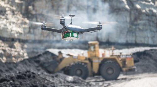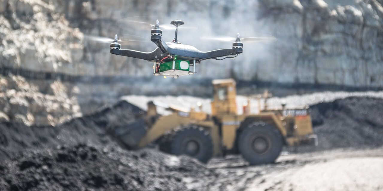
Drone use rising in mines, with surveying and mapping the most common application
The use of drones is increasing across the mining sector, driven by benefits such as improved productivity, safety, and reduced costs, with a wide variety of uses. These include surveying and mapping; monitoring and inspection; site safety management; tailings dam management; blasting assessment and haul road optimisation.
Surveys of mine sites, both surface and underground, over the last four years by GlobalData have shown that the share of mines that have invested to some extent in drones has increased from 44% in 2018 to 65% in 2022, with 32% in the 2022 survey stating they had either fully invested in drones or made a considerable investment. Mines in Australasia were the furthest advanced, with 75% of respondents stating that they had either fully invested or made a considerable investment in drone technology.
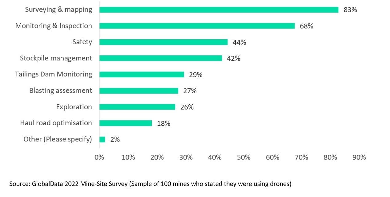
From the 2022 survey, the leading use for drones was identified as surveying and mapping, with 83% of respondents using them for this purpose. There are major savings to be made through drone use. Normally, the surveying and mapping of mineral landscapes is a time-consuming process. By employing drones and a drone pilot instead of a piloted plane, a mine can save around 90% of the cost per hour and collect unlimited aerial data, including fine measurements, by simultaneously capturing high-end orthoimages.
Sponsored Article

Amid increased pressure and urgency around climate change, how can energy operators in the Middle East better measure emissions and help lead the decarbonisation agenda?
Given the scale of global greenhouse emissions and the intractability of fossil fuel use from industry performance, businesses within the oil and gas sector must collate and pinpoint exact areas for improvement, building a bridge between intention and action.
The oil and gas industry is responsible for approximately 10% of direct and 40% of indirect global greenhouse gas emissions, according to a report from McKinsey & Company. At COP26, more than 450 businesses from across the finance sector, collectively worth $130trn, committed to pledge funds to reach net-zero carbon emissions by 2050, putting increased pressure on the energy sector to improve performance, as investors increasingly seek to divest from fossil fuel assets
Monitoring and inspection ranked second – cited by 68% of respondents that used drones – followed by site safety (44%), with both uses not just making on-site activities safer, but also more productive. Meanwhile, managing stockpiles, cited by 42%, can be challenging due to their extreme height and area, which tends to change frequently. Drones enable mining companies to generate aerial terrain models of the inventory.
Tailings dam monitoring ranked fifth, with drones being used for this purpose by 21% of respondents. The utilisation of drones to measure tailings dams can eliminate the risk of manual surveying. There is no need for manual interference within the proximity of the dump when drones are used and by analysing the captured data on a digital platform, mining companies can maintain the structural integrity of the tailings dam, design expansion, and avoid failure.
If you are using drones, what are the main uses? (Please select all that apply)
Source: Mining Technology
![]()